Why we monitor stream bank vegetation
Waikato Regional Council monitors stream bank vegetation to quantify what proportion of the region’s riparian margins requires further stream bank vegetation planting.
The demands on the region’s rivers and streams continue to increase as the result of land use intensification. The long-term management of these resources is a high priority to ensure freshwater quality and aquatic biodiversity within the Waikato region are preserved for future generations.
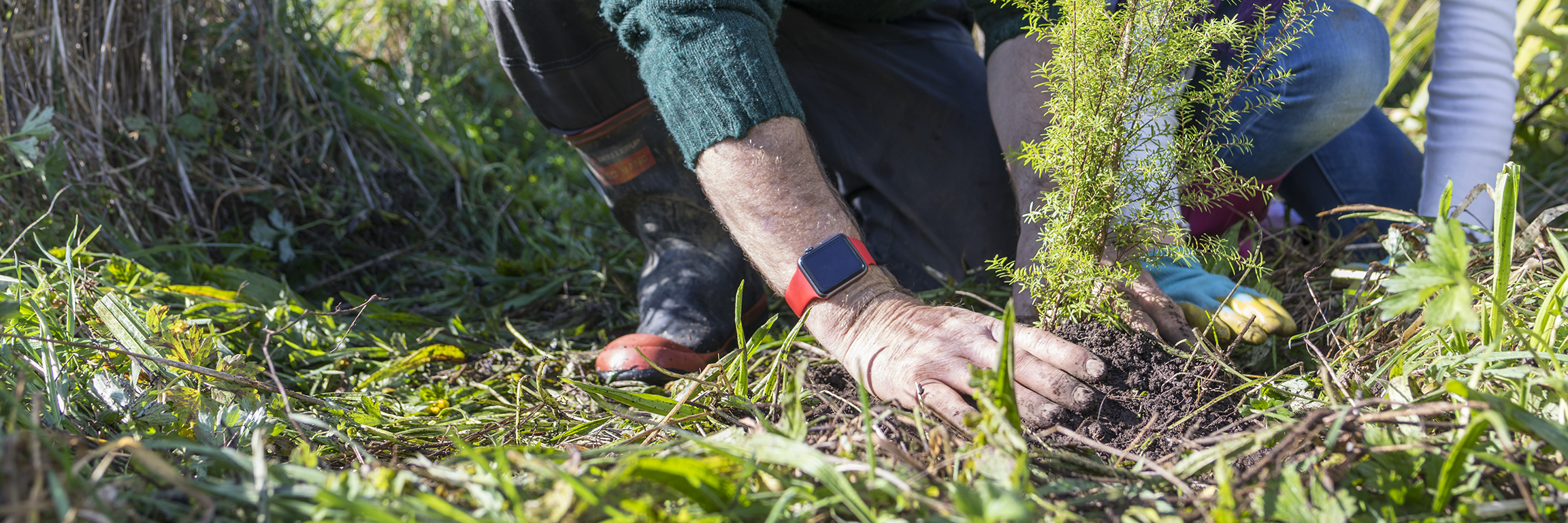
Riparian management techniques such as fencing, and planting of riparian zones are an effective way of improving water quality and increasing aquatic and terrestrial biodiversity.
Regional riparian characteristics survey
The regional riparian characteristics survey provides a repeatable and quantitative assessment of riparian fencing, vegetation, and stream bank erosion through pastoral land in the Waikato region. In addition to supporting catchment management zone works the survey information potentially supports our biodiversity, biosecurity, and environmental education strategies and programmes.
The survey provides a benchmark on stream bank vegetation and, through ongoing monitoring, can provide a gauge of the effectiveness of Waikato Regional Council’s riparian policies.
Results - data and trends
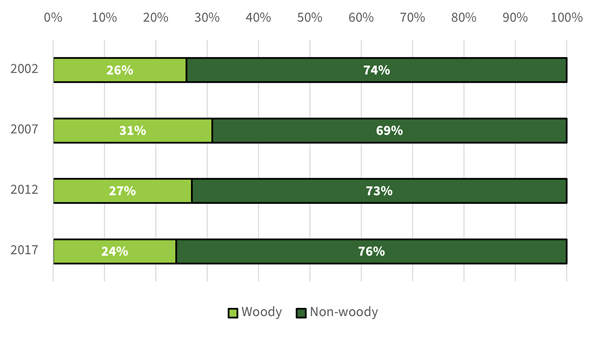
Riparian vegetation has been surveyed along 500 m lengths of waterways (430 sites were sampled in 2022) and the vegetation classified into woody and non-woody vegetation.
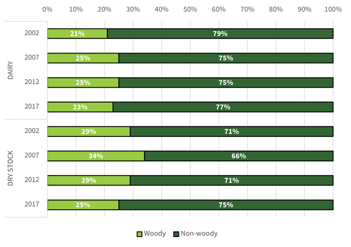
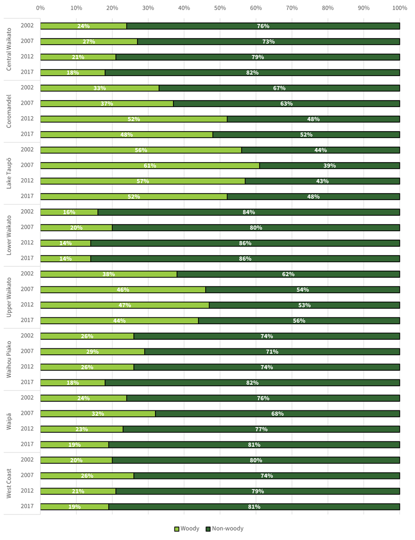
The stream bank vegetation indicator shows:
- The amount of woody vegetation (as a proportion of bank length fenced) across the region has not changed significantly over the 2002–2022 period (26 per cent in 2002 and 27 per cent in 2022).
- There was no difference in the proportion of bank length occupied by woody vegetation between dairy and drystock land uses.
- The woody vegetation is predominantly comprised of woody exotic vegetation. However, the proportion of bank length with woody native vegetation has increased from 5 per cent in 2002 to 11 per cent in 2022. The non-woody vegetation is predominantly comprised of pastoral grass cover.
- Survey results suggest that there is a positive association between effective fencing and woody vegetation (i.e. effectively fenced bank length has a higher proportion of woody vegetation than bank length that is not effectively fenced).
The Excel spreadsheet below contains the source data to this indicator's graphs and any additional data.

How we monitor
More information
When this indicator is updated
The indicator is updated every five years. Data has been collected in 2002, 2007, 2012 and 2022.
Preparations for the next regional riparian characteristics survey, including any refinements to the survey method and design, will get underway in 2026/27. Data collection for the next survey is due to be undertaken during the summer/autumn period of 2027/28.
Last updated August 2025