Waikato regional spatial plan project
About the project
Planning for a better future - together
We’re working on a long-term plan to help the Waikato region grow in a smart, connected, and sustainable way. This project is about making sure we’re ready for the future — thinking ahead about how we use land, build infrastructure and manage resources across the region.
The goal of this work is to set up the Waikato region to be proactive and deliberate about how to plan land use, infrastructure and resource management for the future in an integrated way.
What is the regional spatial plan project?
A four-year project (2024-2028) that aims to work towards producing a shared strategy for how the Waikato region could look and function in the future. The project provides an opportunity for councils, iwi and other partners to come together and take a big-picture view by looking across the whole region to understand what our communities need and how we can support them.
By working together, we can create a clear vision - a kind of “north star” - and a roadmap to help us get there.
Regional spatial planning will complement and benefit from all of the work done by other councils and agencies in spatial planning and placemaking, such as through the Future Proof growth partnership.
This work will also:
- reduce duplication of effort by councils, and
- make better use of funding and resources and support smarter, more coordinated decision-making.
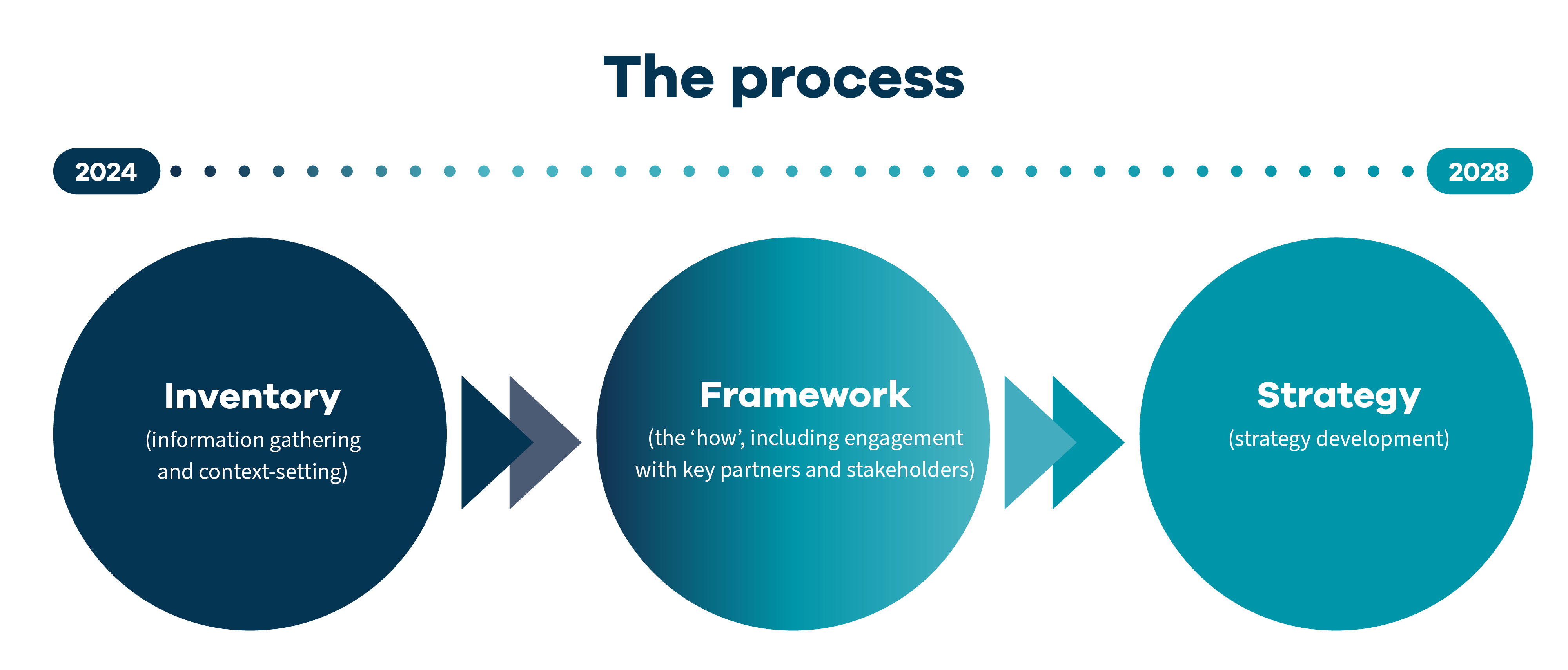
The inventory - understanding what information and resources we already have
We are building an understanding of what information we have across the region, what we need to gather and how we go about doing this. This will enable a regional approach to responding to regional issues. It will also help to integrate local and central government funding and investment.
The inventory is a stocktake of relevant existing spatial information, spatial data, planning information and strategies within the Waikato region.
The purpose of the inventory is to identify and collate existing work in the Waikato region that can be used to inform a regional spatial strategy and to identify gaps.
The region’s existing spatial information and data is fragmented and district or subject-specific, and there are gaps and inconsistencies in the data.
The inventory was presented to a Waikato Regional Council workshop in April 2025 as a report with supporting maps and figures to illustrate the current state of spatial information which may inform a regional spatial strategy and be a platform for future work.
The inventory outlines a regional profile that spatially presents the current state of the region through a set of maps/dashboards. Key messages are presented in supporting infographics.

The framework – how are we going to go about it
A framework has been developed which sets out how partners could work together to build the regional spatial strategy. The draft framework has been shared with our district and city councils and our iwi partners. The framework also covers timing and resourcing to prepare a strategy - who’s involved, how we’ll work together and what resources and timeframes are needed.
The strategy - a shared vision for the future
What might a regional spatial strategy look like?
A key component of the strategy will be a map or set of maps that show how partners want the region to look in a variety of possible futures. The strategy will include maps that show:
- Places where development could happen and where it shouldn’t, including where we should be retreating from
- Infrastructure investment corridors
- How we can be better connected through transport, community, economic and nature linkages
- Opportunities for things like renewable energy
- Areas and taonga that we want to protect.
Alongside the maps, there will be a written plan that explains how we’ll move toward this shared vision. The strategy will help guide decisions and investments by communities, businesses and government.
The strategy should provide certainty about the future of the region to guide decision making and investment by communities, commercial entities and government.
How does our spatial strategy project fit with national resource management system changes?
The Government is reforming the resource management system and regional spatial planning is part of that. The Waikato region is getting ahead by preparing now so we’re ready to respond, whether the strategy becomes a legal requirement or not.
We’re keeping an eye on legislative changes and will adjust our timing to stay aligned.
The inventory will give our region a good grounding for preparing a regional strategy regardless of whether it is non-statutory or a statutory requirement.
Who can I speak to if I want to know more?
If you are interested in learning more, please email: strategicandspatialplanning@waikatoregion.govt.nz