

Waikato Regional Council operates and manages two flood protection schemes in the Lake Taupō catchment, where the Tongariro and Tauranga-Taupō rivers feed into the eastern side of the lake.
Waikato Regional Council also undertakes works on rivers within the Lake Taupō catchment directed at controlling bank erosion, channel instability, riparian vegetation and the aggregation of riverbed sediments, and has long-standing relationships with primary hydro generators Mercury Energy and Genesis Energy to work closely on implementing a high flow management plan during times of flooding, to control water flows in and out of the lake.
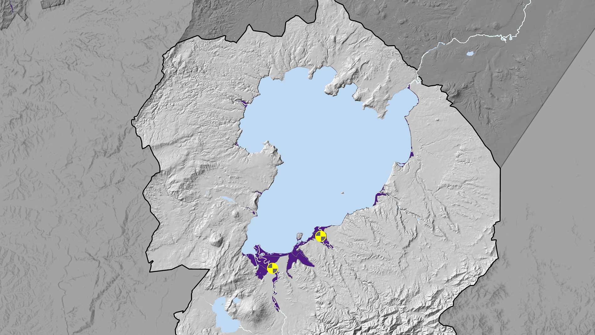
The yellow areas on this map show the locations of the two flood protection schemes at the south end of Lake Taupō. The purple areas indicate land that may be susceptible to flooding based on historical event records, flood modelling, flood protection and drainage scheme data, and elevation information.
Tongariro flood protection scheme
-
The Tongariro River, located to the south of Lake Taupō, has a history of flooding events. Specifically, the township of Turangi is located at the entrance to the river delta and identified as being at risk from certain flooding events, along with adjacent land.
Early flood protection measures were put in place around Turangi in the 1960s after a severe flood in 1958. Further construction work was undertaken by the Taupō District Council after a flood in 1998, and a scheme redesign by Waikato Regional Council was undertaken after a flood event in 2004. This upgrade was completed in stages between 2005 and 2008. The scheme was agreed to by the community, who benefits and mostly pays for it via targeted rates. It is designed to handle a 1% annual exceedance probability (AEP), which is often called a 1-in-100-year flood event, and has an estimated design flood flow of 1500 cubic metres per second.
The Tongariro River is a constantly changing river system. Riverbed sediments are actively building up and moving through the river channel and have a major influence on the river.

The Te Herekiekie Street stopbank in Tūrangi was built after the severe Tongariro River flood of February 2004, when the river burst its banks and inundated around 30 homes in the street.

Tauranga-Taupō flood protection scheme
-
The Tauranga-Taupō River has a history of flooding events, resulting in inundation of land within the lower reaches of the river. Specifically, the communities of Oruatua and Te Rangiita and adjacent farmland, are identified as being at risk of inundation from certain flooding events.
The Waikato Valley Authority put the first flood protection scheme in place in 1981 following major flooding events in 1958 and 1964. A significant flood in 2001 resulted in the Tauranga-Taupō River breaking out of its channel and forming a new course. The new channel, and dewatering of the former channel, changed the balance of flood risk in the lower catchment and adversely affected the trout fishery in the lower reaches of the Tauranga-Taupō River.
In response to the 2001 breakout, Waikato Regional Council constructed a flood protection scheme, and undertakes various river management works in the Tauranga-Taupō River and associated riparian margins. The scheme was agreed to by the communities, who benefit and pay for it via targeted rates. It is designed to handle a 2% annual exceedance probability (AEP), which is often called a 1-in-50-year flood event, and has an estimated design flood flow of 318 cubic metres per second. Construction was in two stages and completed between 2005 and 2008.

Work on Kiko spillway and Maniapoto Bend as part of the Tauranga-Taupō River flood protection scheme, 2004.